By Lon Anderson
Moorefield Examiner
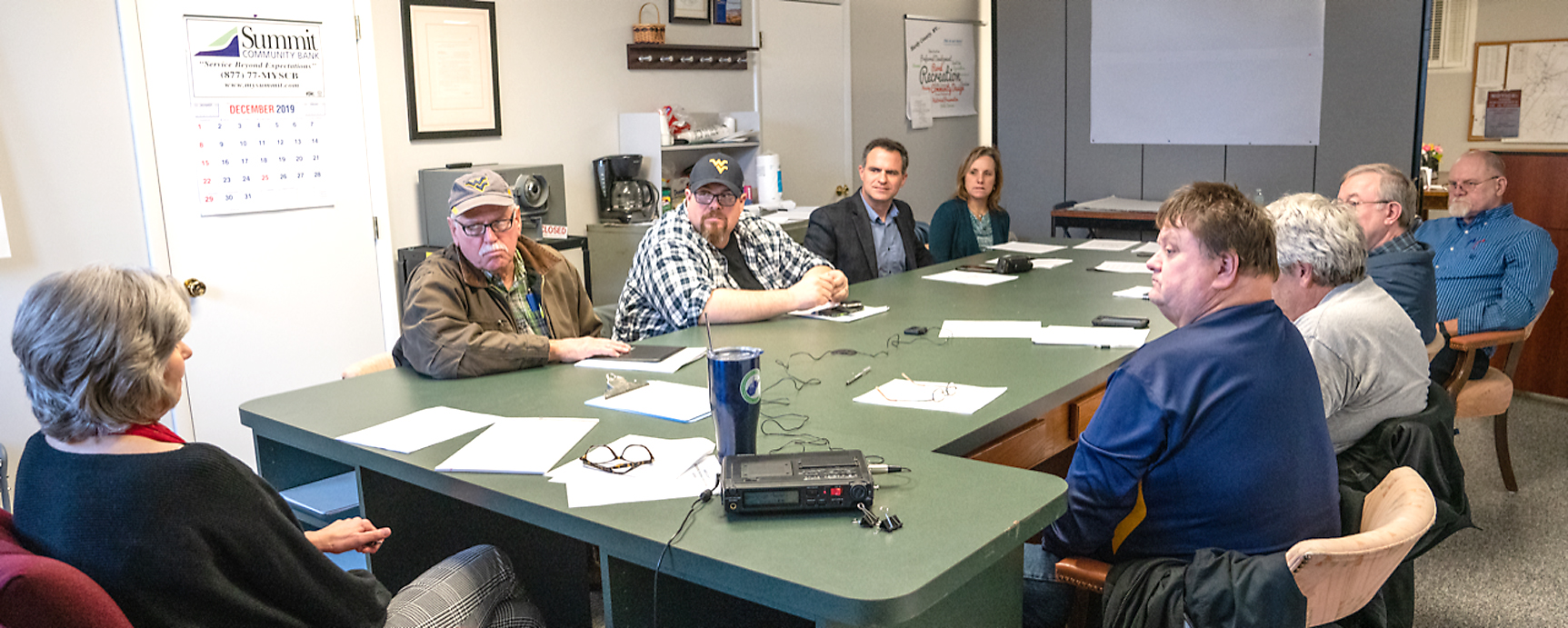
A new chapter in the management of Hardy County’s GIS system began on December 18 when the County’s newly constituted GIS Board held its first meeting in the County Planning Office.
GIS, which stands for geographic information systems, is a key management tool that will be assisting many of the County offices to more efficiently achieving their missions. GIS is a high-tech system for managing data that’s related to locations. More specifically, the program creates maps with a great deal of detail on a variety of subjects that allow users to manipulate, analyze and store that data in ways that best serve their purposes.
When an ambulance driver needs to get to an address quickly, or when the Planning Office wants to see how tracts of land are zoned in a given area, or the Tax Assessor needs data concerning property taxes, they’ll turn to the GIS system for the information.
County leaders think the system is so important that in October the County Commission passed a resolution creating the GIS Board to oversee its management and use. So, the December meeting of the Board was its first, and those around the table spent much of the meeting working on how best to get organized and move forward.[private]
County Planner Melissa Scott, who has more than 25 years of experience with GIS systems, opened the meeting offering a very straightforward agenda that addressed such basics as discussing the Board’s purpose, functions and duties. Around the table, besides Scott, were much of the County’s leadership: County Commissioner David Workman; Public Service District General Manager Logan Moyers; Dave Maher representing the Sheriff’s Office; citizen representative Amy Maher; County Clerk Greg Ely; Emergency Management Director Paul Lewis, County Surveyor Dave Jopling and County Tax Assessor Jim Wratchford.
After a brief discussion of the proposed by-laws drafted by Scott, Board members voted unanimously to pass them with only minor changes. Under the new by-laws, only seven of the eight members would be voting, with Commission Member Workman a non-voting member, and a quorum would require four members to be in attendance. The by-laws will now have to be forwarded to the County Commission to be reviewed and approved.
The Board members also discussed creating a five-year plan to guide their efforts, and discussed which software package from the contractor would best serve the County. Scott explained that the least expensive plan allowed only one user at a time for approximately $6,000 and a larger plan that would allow unlimited “seats” for $10,000.
“It makes sense to have the unlimited option,” Member Dave Maher said. Another member noted that this would only cost each department per year.
“If we’re all interested in this, I can talk to the contractor and see what we can get,” Scott said, noting that they would want credit for what’s been paid on the limited contract currently in place.
Board Member Lewis raised several questions, including whether the package included updates and maintenance, and whether it would be cloud based?
“Cloud based would not work for everybody in Hardy County,” Scott noted, since there are areas in Hardy with no access to the cloud.
“Who has custody of the data in the cloud versus on our own servers?” Maher asked. He also wanted to ensure that the data and access to it would be law-enforcement sensitive. One of the tricks to making this work is the training, Maher said, but cautioned that the cost of training can easily exceed the cost of the software.
There was general agreement that they needed to have the GIS software contractor present to help them understand how the system works and answer their questions quickly. Scott said she would seek to have him attend the Board’s January meeting.[/private]